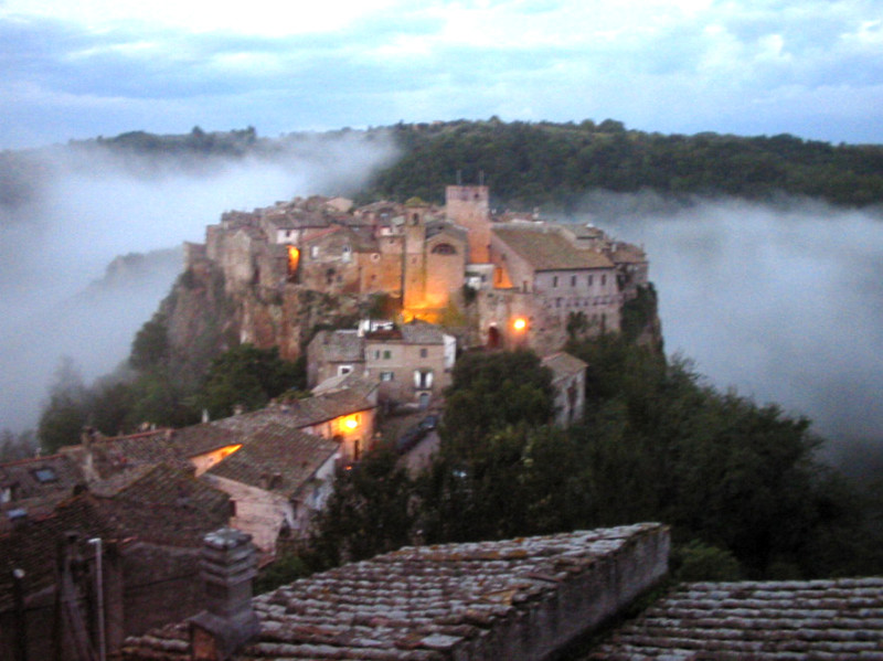
 This walkway is coming reaching by car the north of Rome, and Federal Highway (Strada Statale – S.S.) 2 Cassia.
By the car continue on the Via Cassia , and we go out to Mazzano Romano exit. From there , beyond Mazzano Romano , follow the signs to Calcata , where you should leave the car along the main road, next to the entrance of the village.
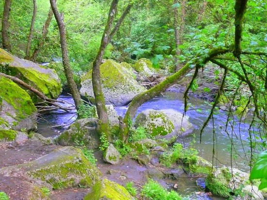
The path, with the sign “Via Narcense – Civita Castellana ,” begins falling to the right of a large table of the Park, from the small square before the entrance to the village (160 m). Starting the descent , you should immediately turn left at the ” nature trail Calcata – St. Maria ,” but continue straight meeting , from time to time , the classic white-red signs with numbered ” 013 ” , and enjoying a a certain point of a wonderful view of the village of Calcata perched on the rock. After a stretch on a brick paving blocks of tufa , it continues to fall on the dirt track coming soon Treja along the river on our left . Reached a height of two fallen trees on the river (84 m , about 45 minutes from the start) , the vegetation becomes more dense , and then uncover for a short distance on the left. Without any difference , it proceeds to a lot ‘ in a continuous alternation of light and shade, strokes and other more sunny covered with vegetation ( hazel , elder, wild plum , maple … ) .
About 3 hours before departure, always on the river , you arrive at the confluence of Treja with the Fosso della Banditaccia , a small stream that comes from the right ( often almost dried up in summer) . It should take just a few yards before the confluence , a deviation is not evident on the right that leads to skirt the Fosso della Banditaccia on our left , almost reversing the direction of travel. Soon enough, after only a few minutes in the dense forest , it crosses the Fosso (92 m) and up the other side for a trace of the path, until you reach a footpath (118 m) which must be taken to the right. The following is going in a more decisive manner , seeing at one point , in a large bush on the left , an old car thrown from above. We then move next to the walls of tufa, finally overtaking the fence that borders the dirt road. Take the road to the left, in a moment he arrives at the castle Foiano (169 m) to the left of the road. Ancient castle remains standing the ruins of the tower along with other ruins .

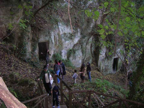
 Just below , are the caves dug arriving almost under the tower. The main glance , the castle is on the thick vegetation that covers the wide canyon carved by the river Treja .
Wanting to go a different route on the way back , you take the dirt road in the direction from which we came and follow it in full , slightly uphill , to a metal bar . Beyond this point , the road becomes paved , then coming to cross the road that leads from Faleria Calcata . Taking the road towards the right, after a few hundred meters you leave turning right in the direction of Calcata Nuova , coming immediately after Calcata Old (about 2 hours from the castle of Foiano ) .
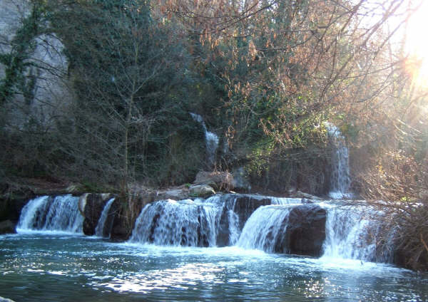
Returning to Rome , is recommended a visit to the characteristics waterfalls of Monte Gelato . Passed Mazzano Romano , after a while ‘ there are signs of turning left to the falls.
Mappend on July 14, 2013 by www.gambeinspalla.it , a beautiful project but , it seems, is in stand -by mode. I tried to contact the filmmakers ( walkers ) but did not succeed . Hoping to do something unpleasant , I decided to copy- paste the path …
– See more at : http://www.ammappalitalia.it/calcata-castello-di-foiano/
How to get to the starting point :
BY CAR:
From Rome : take the SS2 Cassia up to 35,400 km , continue to Mazzano Romano . Or take the SS3 Flaminia to Km 38.500 ( Rignano Flaminio ), continue to Faleria , Calcata and then Mazzano Romano .
From GRA : Exit 5 Veientana Cassia (SS2 Cassia bis ), continue towards Viterbo until the exit for Mazzano Romano .
From Viterbo : follow the SS2 Cassia Cassia Cimina or the most scenic in the direction of Rome , overcome Monterosi , exit at Mazzano Romano .
From the A1 : exit Magliano Sabina , continue on SS3 Flaminia towards Rome to Civita Castellana , Faleria , Calcata and then Mazzano Romano .
BY PUBLIC TRANSPORT :
Rome » Mazzano Romano
The departures are from the terminus Cotral Saxa Rubra .Toll COTRAL : 800150008
(Mon-Fri 6:00 to 20:00 h – Saturday 9:00 to 17:00 h )
Marco Saverio Loperfido nasce nel 1976 a Roma, dove si laurea in filosofia presso l’Università La Sapienza.
Nell’ambito del più ampio progetto “Ammappa l’Italia” , di cui è cfondatore, Marco, nella primavera del 2014 intraprenderà un cammino per gli antichi borghi collinari della Tuscia, passando attraverso tutti i 60 comuni della provincia di Viterbo, in meno di 80 giorni (marzo-aprile).
Il giro della tuscia in 80 giorni al fine di promuovere il territorio e il progetto di archiviazione web dei percorsi a piedi italiani. Liniziativa ha il Patrocinio della Regione Lazio.
Questa idea nasce dalla scommessa che tutto il territorio italiano sia attraversabile a piedi, senza macchina, senza nemmeno prendere un treno o un bus, semplicemente percorrendo strade sterrate, tratturi, mulattiere, sentieri veri e propri, fino a qualche decennio fa ancora frequentati e usati dai contadini e dai viaggiatori di tutte le nazioni.
